


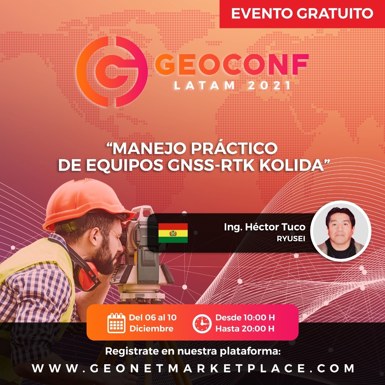
Es un resumen de manejo de equipos GNSS-RTK, donde es muy importante tomar algunos parámetros de configuración y corrección para obtener datos fidedignos de la superficie terrestre, que se vaya a representar sobre un marco de referencia, un sistema de referencia.
Ponente :
Ing. Hector Tuco Huanca
( RYUSEI - INCITEC)
Bio: FORMACION ACADEMICA EN LA UNIVERSIDAD MAYOR DE SAN ANDRES A NIVEL TECNICO SUPERIOR, EN TOPOGRAFIA Y GEODESIA. TRABAJO POR MAS DE 10 AÑOS EN EL INSTITUTO NACIONAL DE REFORMA AGRARIA - BOLIVIA. COORDINADOR Y ORIENTACION A NUEVAS EMPRESAS IMPORTADORAS SOBRE EQUIPOS DE TOPOGRAFIA Y GEODESIA. SOPORTE Y SERVICIO TECNICO EN EQUIPOS DE TOPOGRAFIA, GEODESIA Y FOTOGRAMETRIA. ACTUALIZACION EN LA FORMACION ACADEMICA A NIVEL LICENCIATURA, EN EL AREA DE GEOMATICA.
MANEJO Y CONFIGURACION DE EQUIPOS GNSS.
10/12/2021
Hora Inicio : 09:57
Hora Fin : 10:45
Hora Fin : 10:45
Ver Ponencia
COMPRA SEGURA. Al comprar por Geonet su dinero esta protegido.
Es un resumen de manejo de equipos GNSS-RTK, donde es muy importante tomar algunos parámetros de configuración y corrección para obtener datos fidedignos de la superficie terrestre, que se vaya a representar sobre un marco de referencia, un sistema de referencia.
Ponente : Ing. Hector Tuco Huanca
( RYUSEI - INCITEC)
Bio: FORMACION ACADEMICA EN LA UNIVERSIDAD MAYOR DE SAN ANDRES A NIVEL TECNICO SUPERIOR, EN TOPOGRAFIA Y GEODESIA. TRABAJO POR MAS DE 10 AÑOS EN EL INSTITUTO NACIONAL DE REFORMA AGRARIA - BOLIVIA. COORDINADOR Y ORIENTACION A NUEVAS EMPRESAS IMPORTADORAS SOBRE EQUIPOS DE TOPOGRAFIA Y GEODESIA. SOPORTE Y SERVICIO TECNICO EN EQUIPOS DE TOPOGRAFIA, GEODESIA Y FOTOGRAMETRIA. ACTUALIZACION EN LA FORMACION ACADEMICA A NIVEL LICENCIATURA, EN EL AREA DE GEOMATICA.